Views: 14
Researchers are training an AI that can capture soil properties without the need for elaborate soil sampling for creating drinking water concepts for cities – just aerial photographs
Source KIT: Water is one of the most important resources for us humans – be it as drinking water or irrigation in agriculture. In some regions, which are already struggling with water scarcity, supply is severely threatened by, for example, climate change. At the same time, the demand for water is increasing worldwide. For the development and implementation of drinking water concepts for cities in water shortage regions, it is crucial to obtain precise information about the soils in the catchment area of rivers. This is difficult especially in rough terrain. Researchers at the Karlsruhe Institute of Technology (KIT) are now working on an AI-based method that can use aerial photographs and satellite images to provide reliable information about soil properties.
“Some soil properties can already be obtained with conventional image analysis methods. However, parameters such as soil moisture and soil type can only be detected through elaborate samples, “says Felix Riese from the Institute of Photogrammetry and Remote Sensing (IPF) at KIT. This is difficult or impossible with rough terrain. This is where the physicist begins his research project: “We are working on an artificial intelligence that only uses satellite and aerial images to determine information about, for example, the soil moisture, the type of vegetation or soil composition. These relationships are often so complex that a human being can not describe them using a conventional algorithm. Our AI should identify and link them independently. ”
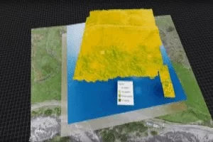
In a joint campaign with KIT’s Institute for Water and Water Development, which Riese coordinated, KIT researchers in Peru sampled soil. In addition, they scanned their entire study area with a special camera mounted on a hexacopter. It takes pictures in the hyperspectral range and displays hundreds of times more visible information than normal cameras. “With this data, we train the AI until it evaluates the aerial images to match the values we measured.”
In Peru, the researchers not only took soil samples, but also scanned the entire study area with a special camera mounted on a hexacopter.
In order to use the method outside of the test area in Peru, Riese and his colleagues feed data from areas in the AI that are drier or have different vegetation. “If we train the AI properly, tedious and expensive on-site measurement campaigns are no longer needed to get accurate information on the status of the groundwater,” says Riese. The goal is that a sufficient satellite image. In future, these evaluations could, for example, support the faster and cheaper implementation of drinking water concepts for cities.
TRUST: Drinking water supply sustainable, fair and ecological
Felix Rieses research is part of the project TRUST under the coordination of Sina Keller. Experts from various institutions and disciplines are working together here to develop holistic planning tools and novel, sustainable water supply and sanitation concepts, especially for the drinking water supply, using the example of the Lima / Peru water catchment area. The University of Stuttgart (coordination), the KIT, the Technology Center Wasser, Disy Informationssysteme GmbH, decon International GmbH, Ingenieurbüro Pabsch & Partner and the Ingenieurgesellschaft mbH are working together in TRUST. The Federal Ministry of Education and Research (BMBF) supports the project.
Details about the KIT Climate and Environment Center: http://www.klima-umwelt.kit.edu External Link
Leave a Reply